Real water routes: Lake Ontario, the Thousand Islands — and both sides of the border
A few days ago, real-water routing covered Georgian Bay and the North Channel. It now covers Lake Ontario and the Thousand Islands too — and in both regions, US harbors route on real charted depths.
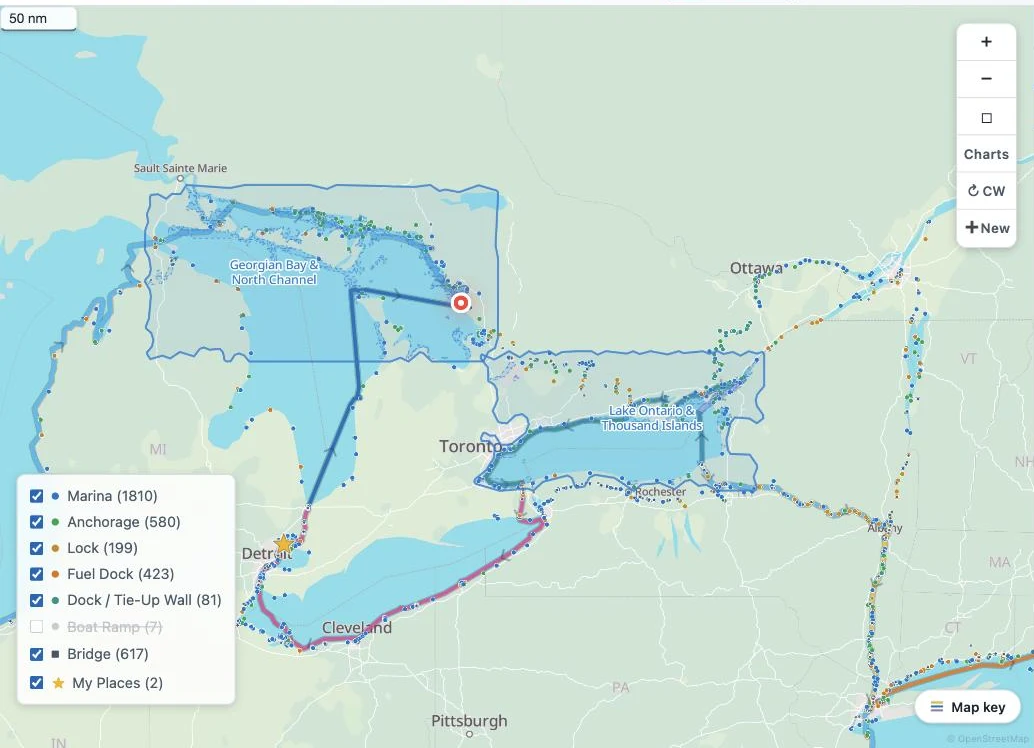
New water: Toronto to Brockville
The whole Canadian Lake Ontario shore now routes on charted depths and your boat's draft — Toronto, Hamilton and the Niagara shore, the Bay of Quinte, Kingston, and the Thousand Islands down to Brockville, including the island channels.
US harbors carry real depths now
Depth data from US harbor charts joins the Canadian soundings in both regions. On Lake Ontario that means Oswego, Sackets Harbor, Henderson, Chaumont Bay and Cape Vincent; on northern Lake Huron it means Mackinac Island, Mackinaw City, Cheboygan, DeTour Passage, Drummond Island and Rogers City. Charted rocks, wrecks and obstructions are kept out of the line the same way surveyed rock is on the Canadian side.
Open-lake US water still routes with unverified depths — and the map says so, plainly.
See exactly where it works
On the planner map, open Charts and turn on “Routing coverage”: the shaded shapes are the waters where routes follow real depths.
Held to a captain's standard
Every release of the routing engine is checked against a growing library of real cruising routes drawn by hand on marine charts — 44 of them now, from harbor hops to a 122-nautical-mile open crossing.