Auto-routing reaches southern Lake Huron — and now you can see where routing lives
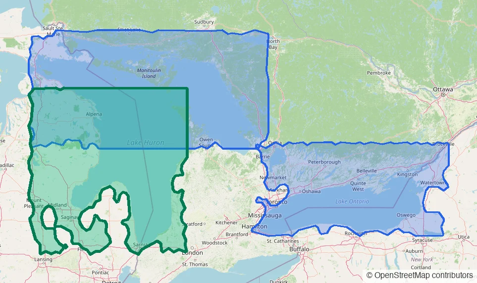
Real water routes now cover the Port Huron corridor, Saginaw Bay, and the open lake up to Georgian Bay — and a new map layer shows you exactly where automatic routing is available.
New water under the router
Pick a destination along southern or mid Lake Huron — Port Huron up the Michigan shore, into Saginaw Bay, or across toward Tobermory — and the planner now answers with a real water route: around the shoals, through the charted channels, honest about depth.
That makes three connected regions of covered water: Georgian Bay & the North Channel, Lake Ontario & the Thousand Islands, and now Lake Huron.
See the coverage, don't guess it
Open the planner's Chart Overlays and switch on Routing coverage. Shaded outlines show exactly where automatic water routing is available today — so when a route comes back as a straight line, you'll know whether you're outside covered water or truly off the network.