Auto-routing reaches Lake Erie — every Great Lake on the Loop is covered
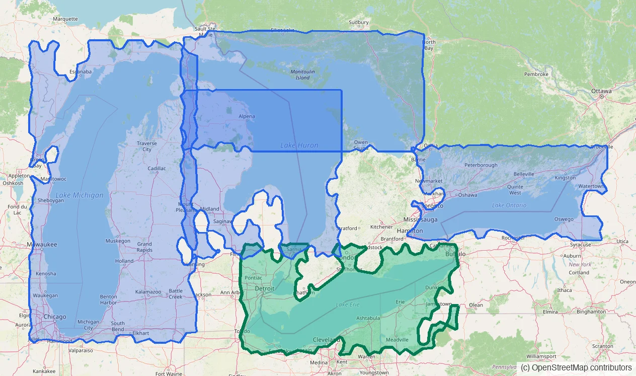
Lake Erie joins the router — and with it Lake St. Clair and the Detroit and St. Clair rivers, so real water routes now flow between Erie and Huron the way boats actually travel.
The Loop's last lake
Pick a destination anywhere on Lake Erie — Buffalo, Presque Isle, Cleveland, the Bass Islands, Toledo, Port Stanley, or along Long Point — and the planner answers with a real water route: around the shoals, through the charted channels, honest about depth.
Coverage runs the whole lake, both shores, plus Lake St. Clair and the rivers on either side of it.
Through the rivers to Lake Huron
Routes now travel between Lake Erie and Lake Huron the way your boat does: up the Detroit River, across Lake St. Clair, and up the St. Clair River past Port Huron. It's the second river connection in the network, joining the Straits of Mackinac — so covered water now runs continuously from Buffalo to Chicago.
Honest at the edges
The Welland Canal is lock water — your planned route carries you between Erie and Ontario, as it should. And in the St. Clair delta, the small-craft channels the charts can't guarantee at your draft are refused honestly rather than guessed.
See exactly where routing lives: open the planner's Chart Overlays and switch on Routing coverage.