Real water routes, channel by channel
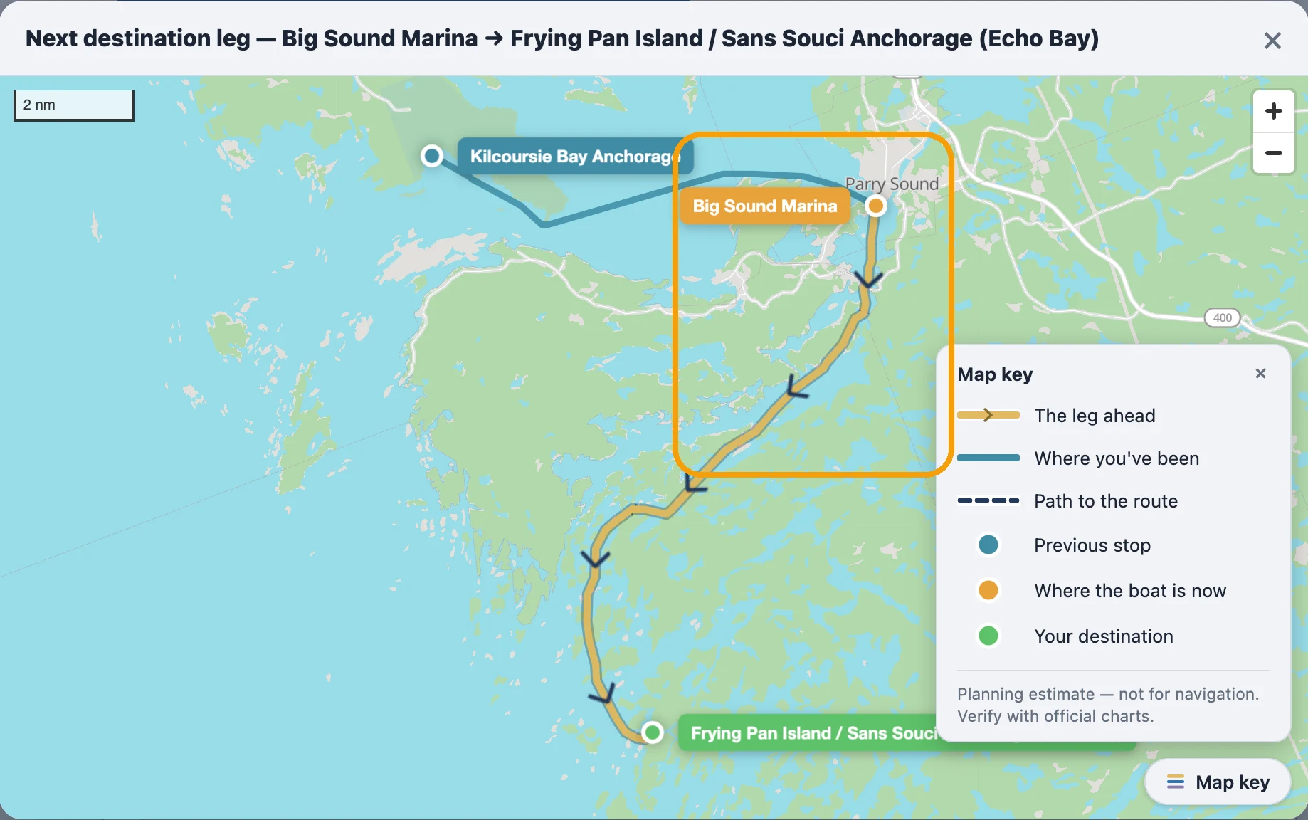
When you set your next stop in Georgian Bay or the North Channel, the route you see now follows the actual water — charted depths, real channels, your boat's draft — down to the small-craft channel behind Parry Sound.
Routes that respect your draft
The line is computed from Canadian Hydrographic Service depth data plus the same coastline the map draws — it never crosses land, and it never sends you through water shallower than your draft plus a safety margin.
The narrow channels count
Mapped channels as tight as a few boat-lengths now route. Big Sound Marina to Echo Bay is about 12 nm through the inside channel — earlier it drew about 18 nm around the outside.
Honest to the last foot
Where charted depth runs thin near a dock or anchorage mouth, the solid route stops at the last water it can vouch for, and a dashed line covers the final approach — that part's yours by eye.
Fast the second time
A route you've looked at before comes back instantly.
Where it applies
This applies to Georgian Bay and the North Channel — everywhere else still uses the standard route.