New: the Lock & Bridge Planner
Pick where you start and where you stop, and the Lock & Bridge Planner lays out every lock and bridge between them in order — when you reach each one, whether it will be open, how long you wait, and where sunset falls. It runs on your boat, your speed and your departure time, and it works on the phone. Bridge Clearance Check now knows the draws too: which ones must open for your air draft, and what it takes to get them opened.
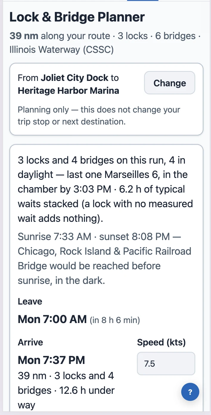
The Lock & Bridge Planner
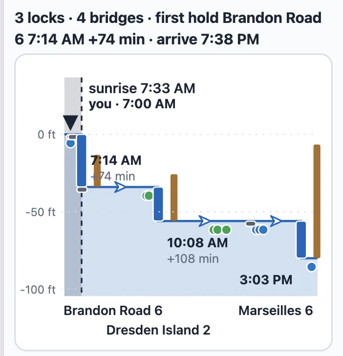
Tools → Lock & Bridge Planner. The run is your trip's next leg by default; tap Change to plan any two places. The map shows the run, the chart shows the locks as steps with the waits drawn on them, and the list under it names every gate with its time and its source. A gate that would hold you says so — Brandon Road 6 · 7:14 AM · +74 min — and the arrival at the top already includes it. A bridge that opens when you get there says nothing, which is the point. On a phone the three pictures sit one under the other: map, chart, list.
On a bigger screen
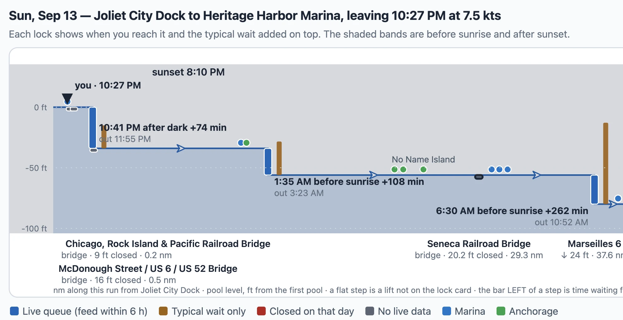
A tablet or a desktop draws the chart wide, with each gate's out time under its arrival and the bridges named under the axis with their closed clearance and mile.
The map and the list
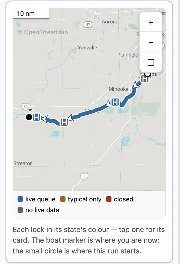
Every lock on the map in its state's colour — live queue, typical wait only, closed, no live data — and a tap opens its card. The list is the working surface on a phone: the row says the time, the wait and where the wait comes from; the card under it carries the chamber, the VHF channel, the day's hours and what the operating authority publishes.
A lock's row, and its card
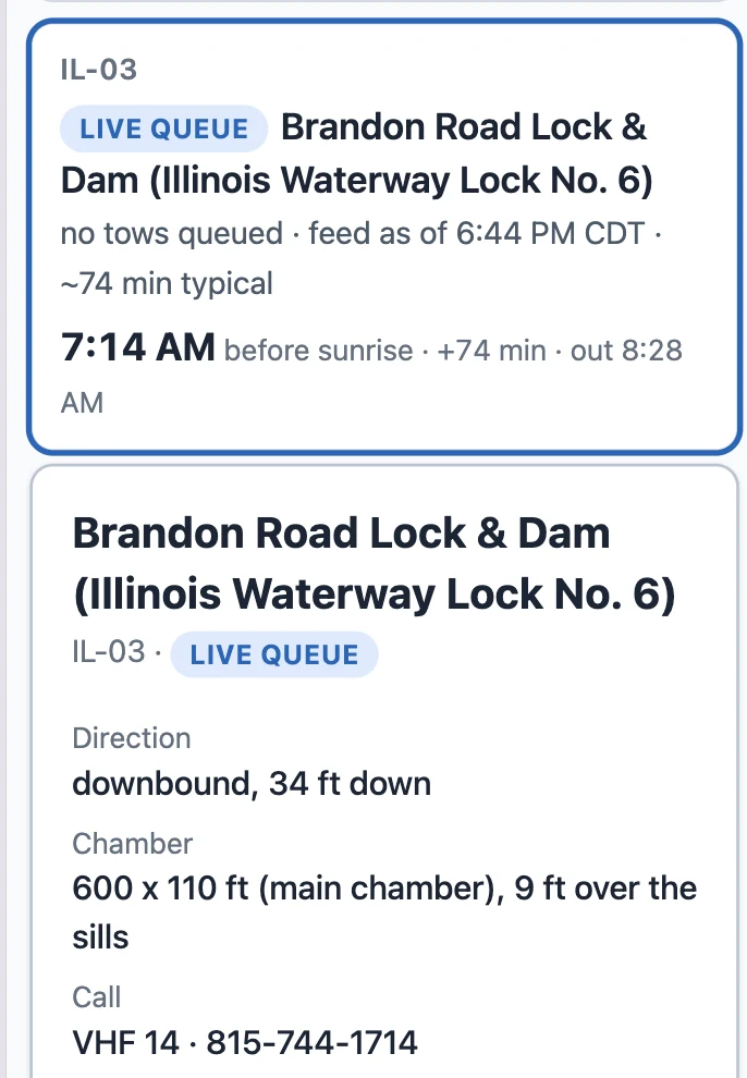
Brandon Road: no tows queued on the Corps feed, 74 minutes typical, in the chamber at 7:14 and out at 8:28. The card says the lift, the chamber, the channel to call and the hours the district publishes for that day.
The whole waterway
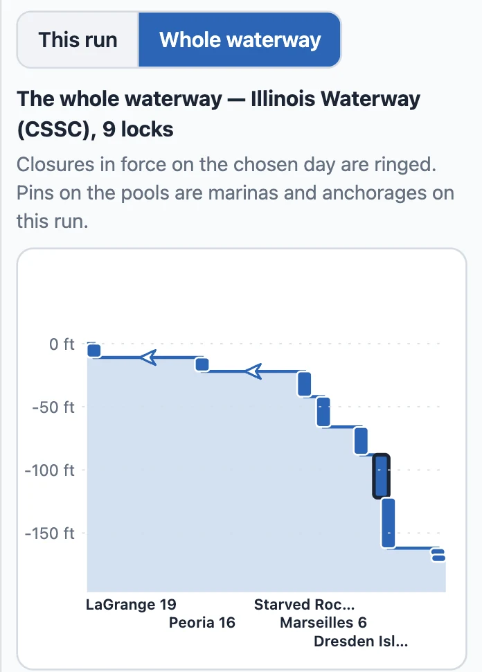
Whole waterway shows the ladder past your run — every lock on the river, a closure in force on the chosen day ringed — so you can see what is coming the day after.
Where the hours come from
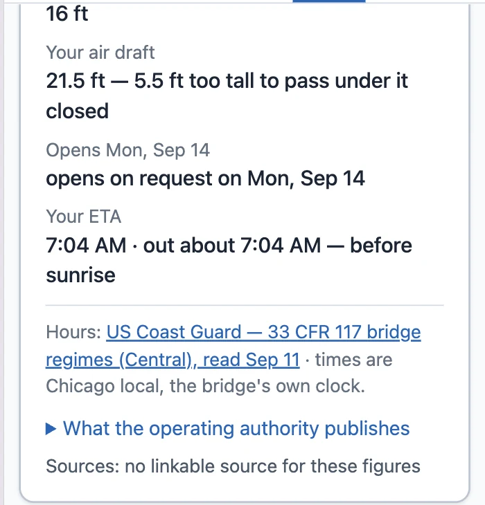
We read the published hours from the people who run the gates: the Coast Guard's bridge regulations (33 CFR 117), the New York State Canal Corporation, Parks Canada, the St. Lawrence Seaway and eleven Corps of Engineers districts — 312 schedules in force, re-read every night, each shown with its source and the date we read it. 207 of the 279 movable bridges on the Loop answer. The Coast Guard's Local Notice to Mariners rides on top: a bridge under repair or a lock on a short week shows as a notice on its card, and where the notice states its hours plainly the planner holds you to them.
Bridge Clearance Check: the draws that must open for you
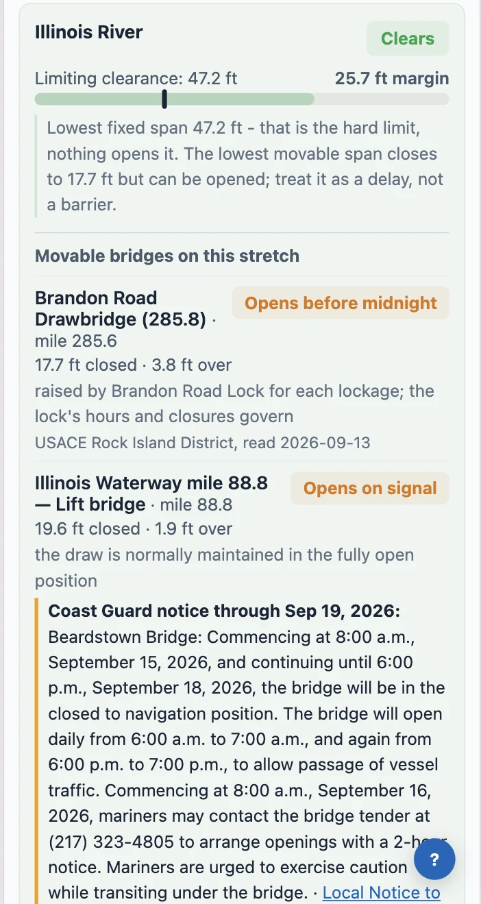
Tools → Bridge Clearance Check. Under each stretch of your route it now lists the draws your air draft can't clear closed and what it takes to get them opened — on signal, on the hour, on four hours' notice — with the regulation's own words and the date we read it. A span too low for your boat that never opens is said as a span you cannot pass, not as a bridge to hail. The Lock & Bridge Planner reads the same rows, so a draw that holds you there is the same draw, with the same time, here.
The day card says who holds you
My Trip's day card and the morning briefing walk today's leg gate by gate at your own usual departure hour and say only what binds: "Northeast 14th Street Bridge, Pompano Beach opens at 9:15 AM; you reach it 9:05 AM — 10 min to wait." A bridge that opens only on notice tells you the deadline to call. Leg Departure Planner shows the shut hours as a band on the departure track and prices the hold into your arrival; Plan Around Your Dates counts a lock that eats the day as the day it eats.
Seasons, from the source
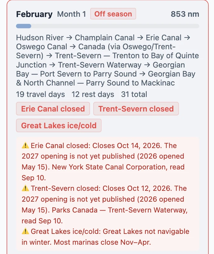
Seasonal Timing Planner used to carry a sentence we typed two years ago. It now reads the canal's own published season, and when a season ends and the next isn't published, it says so. When an authority changes a gate's hours and your plan had you there, the Dates card, the day card and the briefing say it in one line — only when the answer changed, not when the paperwork did.
What it cannot do yet
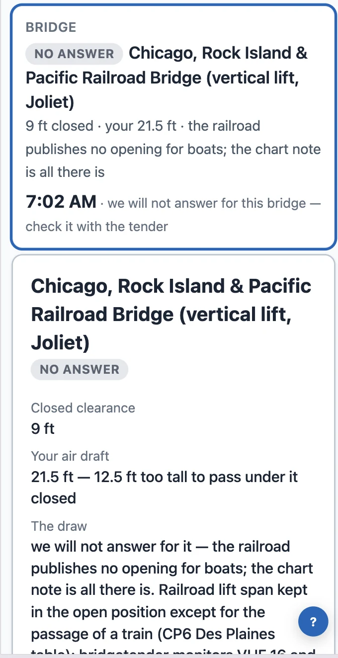
Railroad lifts that publish no opening for boats stay unanswered, by name — we say that rather than guess. A few regulations are written in shapes we cannot hold yet; those bridges show the regulation's own words instead of a time.
Where to find it
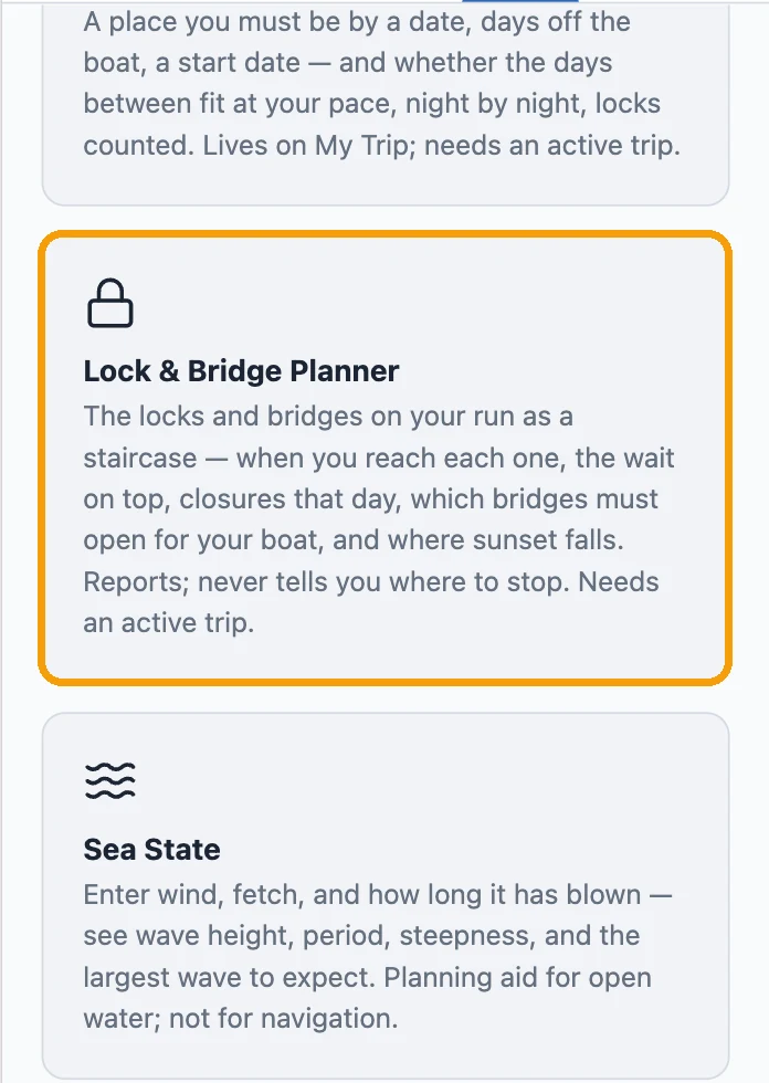
Tools → Lock & Bridge Planner, and Tools → Bridge Clearance Check. Both need an active trip: the plan runs on your boat's profile and your trip's route.